

West Coast Trail Weather
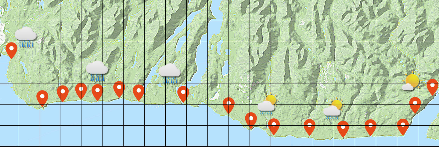
Spanning 75 kilometres of wild Pacific coastline, the West Coast Trail winds through rainforest, cliffs, and beaches shaped by ocean winds and the steep coastal mountains behind it. These forces create shifting microclimates that make weather along the trail famously unpredictable.
General forecasts, like those from the Weather Network, don’t tell the whole story — on the same day it can be pouring rain at Tsusiat Falls while hikers rounding Owen Point enjoy clear blue skies.
West Coast Trail delivers precise, location-based weather forecasts for every major point along the West Coast Trail, including all campsites and key landmarks — giving hikers the local, microclimate-level accuracy that broad forecasts simply can’t provide.
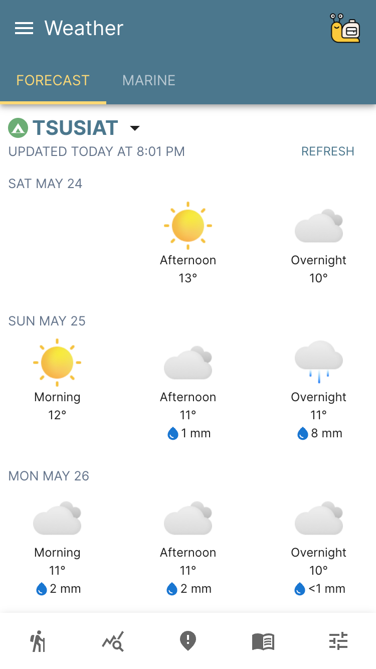
Daily Weather Forecasts
West Coast Trail breaks each day into the three periods hikers care about most:
- Morning - from sunrise to noon.
- Afternoon - from noon to sunset.
- Overnight - from sunset to sunrise.
This simple breakdown makes it easier to plan you day around shifting trail conditions — from early-morning fog to afternoon wind changes and overnight rain.
West Coast Trail uses advanced weather prediction models recognized as the most accurate for this region, including data from NOAA and ECMWF, to deliver reliable daily weather forecasts tailored to the unique microclimates of the West Coast Trail
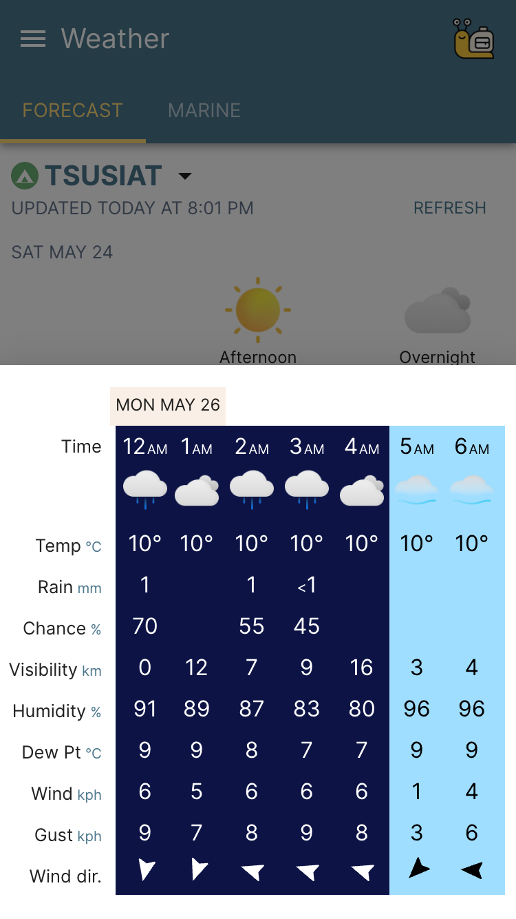
Hourly Weather Forecasts
The hourly forecast lets hikers zoom into precise, hour-by-hour conditions — showing exactly when the rain will ease, the temperature will drop, or the wind will shift.
West Coast Trail automatically selects the best forecast model based on the time until each weather event, ensuring the most accurate short-term data available. Hikers can use this level of detail to make smarter, safer trail decisions — like waiting an extra hour for the rain to pass before breaking camp or taking on the Thrasher boulders.
Locations & Offline
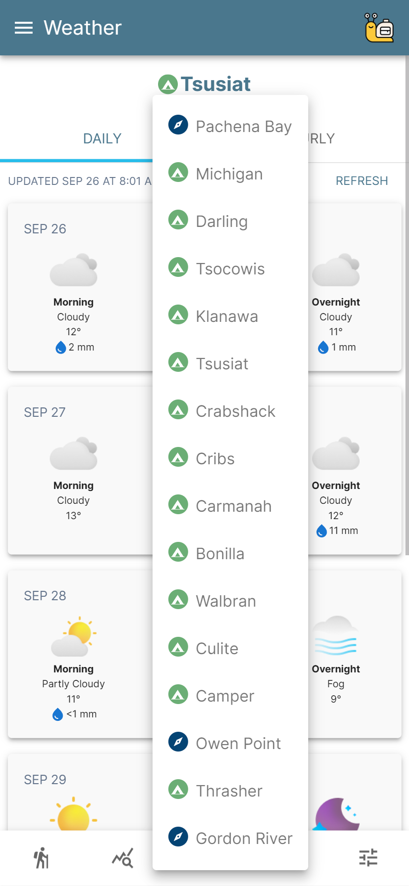
West Coast Trail downloads updated forecasts every hour when you’re online, covering every major point along the West Coast Trail. Once downloaded, these forecasts are stored on your device and remain available when you’re offline — even deep in the forest or far from coverage.
With weather data for every campsite and key landmark, hikers always have access to accurate West Coast Trail weather forecasts, no matter where they are.
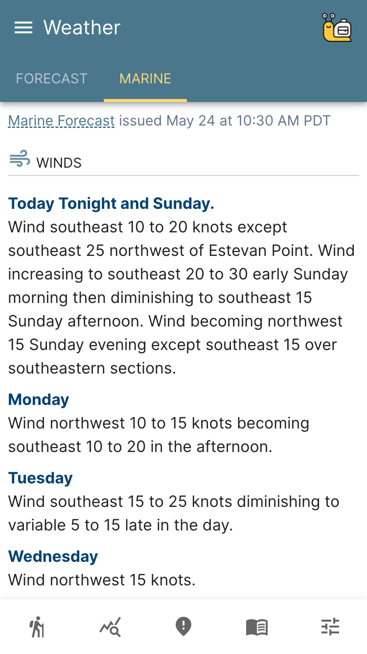
Marine Weather
Experienced hikers know that tide limits on the West Coast Trail can change dramatically with shifting marine conditions. Offshore swell and wind-driven waves can quickly turn calm beaches into dangerous crossings. Parks Canada’s tide limits assume calm seas and light win — conditions that aren’t always the reality.
West Coast Trail includes the complete South Vancouver Island marine forecast, giving hikers real-time insight into offshore wind and wave conditions that affect tide-dependent sections like Owen Point or a Walbran Creek crossing. With accurate marine weather data at your fingertips, you can plan each day with confidence and cross safely when conditions allow.
Planning a trip on the West Coast Trail this year?
Download West Coast Trail, which includes a full interactive map, precision weather, and much more.
Download West Coast Trail, which includes a full interactive map, precision weather, and much more.